| Name | Last modified | Size | Description | |
|---|---|---|---|---|
| Parent Directory | - | |||
| destripedP1.001.png | 2017-09-05 17:43 | 885K | ||
| destriped_P1/ | 2017-09-05 17:42 | - | ||
| destriped_P1_obsid_l..> | 2017-09-05 17:42 | 517 | ||
| postcards/ | 2017-09-05 17:42 | - | ||
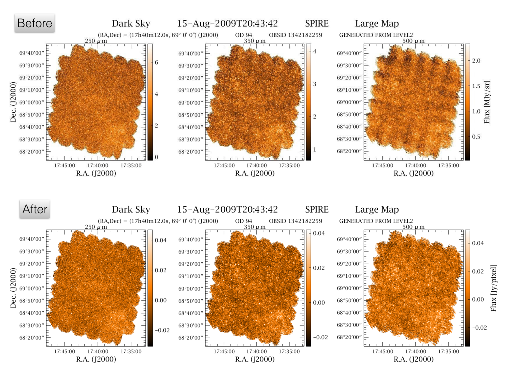
Some SPIRE maps suffer from low-level residual striping. The effect is more pronounced in dark fields where the sources are faint and close to the confusion limits. The residual striping can be alleviated by using the destriper with a higher order polynomial. The default maps have a constant offsets per scan (polynomial of degree 0). The 47 level-2 maps provided as Highly Processed Data Products were generated using the destriper with a polynomial of first degree (linear).
The folder destriped_P1 contains the gzipped FITS files for the 47 OBSID listed in destriped_P1_obsid_list.txt. Only the point-source calibrated version of the maps (psrcPxW) is provided as the great majority of the fields are deep fields. The postcards of the HPDP maps are in the postcards folder.
Note that we only provide level-2 maps which are not part of level2_5. The maps were selected via a visual inspection by instrument specialists and were flagged as suffering from low-level residual striping.
Ivan Valtchanov, 05 Sep 2017, Herschel Science Centre